FROM ASPIRE SOFTWARE
Go iPave
Hundreds of paving contractors across the country use Go iPave to get fast, precise property measurements using aerial and satellite imagery—all stored in the cloud.
Measure, bid, and win more work in less time
High-resolution aerial imagery
Examine every detail to see the pavement condition and cracks in high resolution.
Unobstructed, leaf-off images
Multi-angle property views
Multi-year views for historic inspection
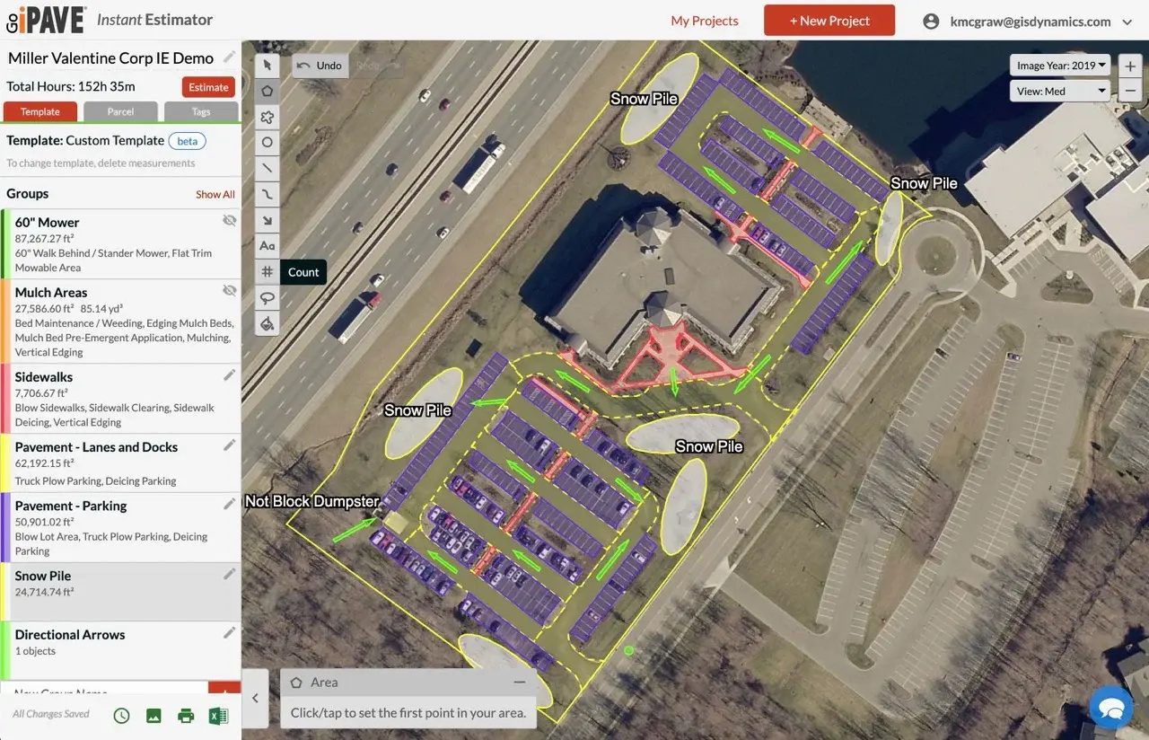
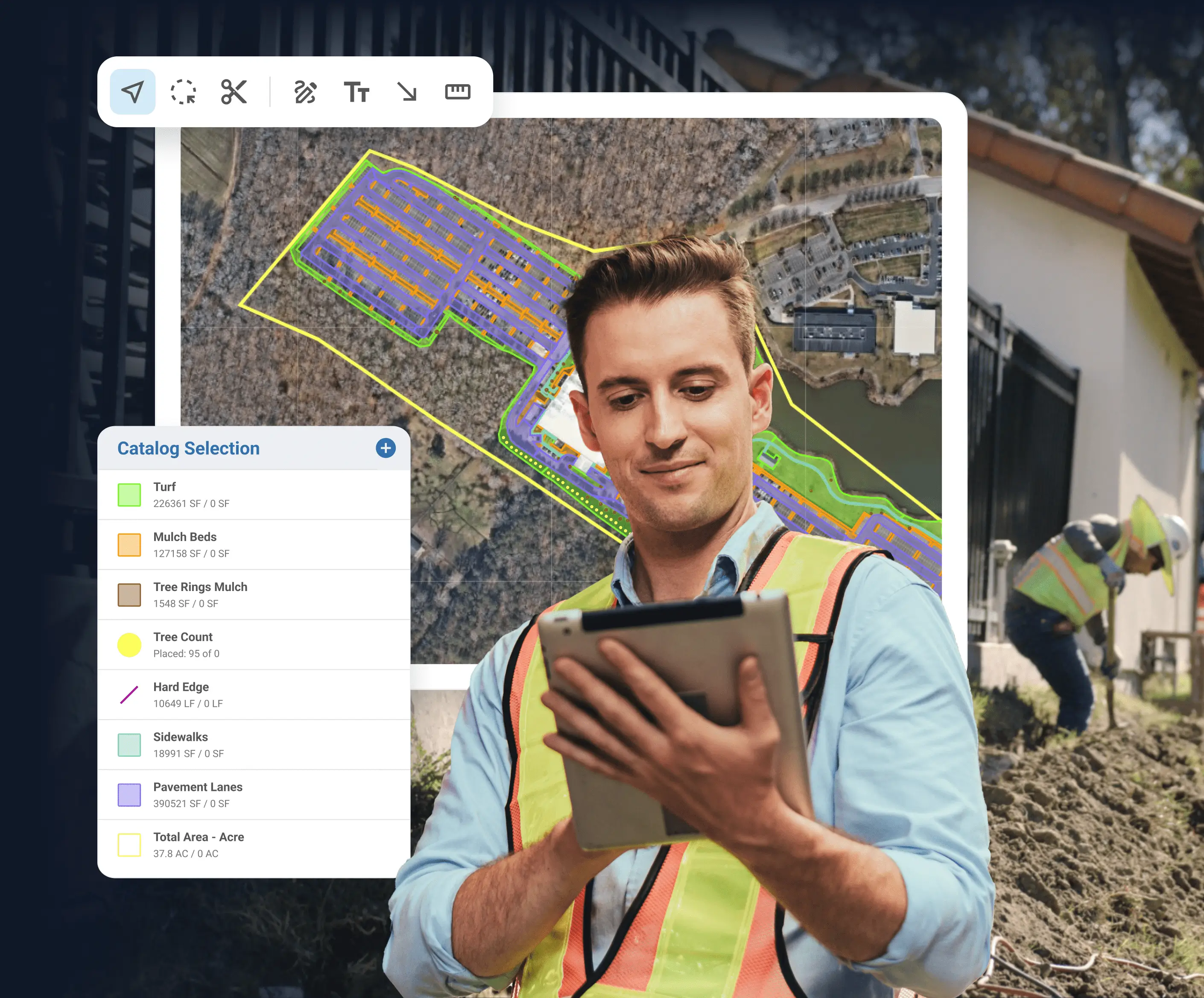
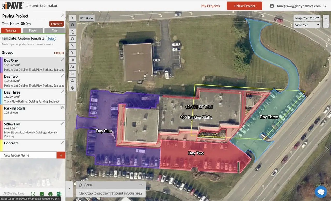
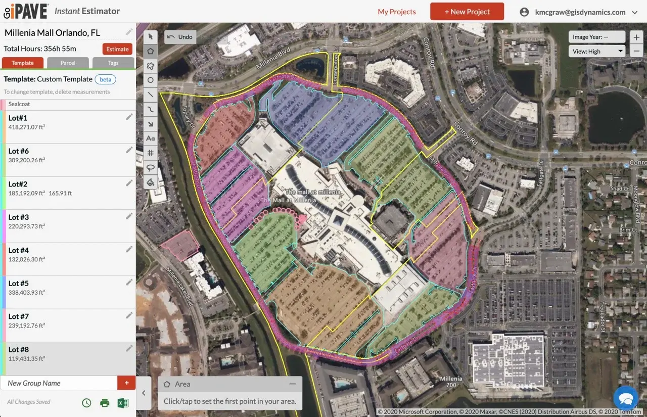
Detailed site plans
Instruct your crews and align stakeholders on the job to be done with clear, visual site plans.
Color-coded areas for phased, multi-day work
Labels for communicating with customers and crews
Directional arrows to guide your crews
Cloud-based solution
Measure properties in minutes to gain your competitive advantage.
Measure anytime, anywhere
Accessible from any internet-connected device
Instantly access and share measurement data
FAQs
Frequently asked questions
How does Go iPave work?
Enter an address and Go iPave will return a property photo to you. Then, with a few clicks of the mouse you can measure any outdoor surface on the property. Export your measurements to Excel, save or print an image of your sitemap, or use Go iPave ShareView™ to send an interactive version of your sitemap to stakeholders.
Is my area covered by your imagery?
We offer 100% coverage of the United States and Canada. The age of the aerial photos varies by county, with more populated areas being updated more frequently.
What is included in a search?
One search is used when you look up a property. Go iPave returns an overhead view, as well as views of the north, south, east, and west sides of the property.
How am I charged?
Go iPave requires a subscription to create and view your projects. You are charged one search credit (pre-loaded onto your account with a subscription renewal or your purchase of a search credit package) in the following scenarios:
An address is searched and an image of the property appears
A project is copied with your authorization
Does Go iPave offer training?
Yes. Our team provides complimentary onboarding calls to ensure you understand how every tool can help you maximize the value of Go iPave. You can schedule a time here.
14-DAY FREE TRIAL
Get started today
See how Go iPave’s property measurement tools can help you gather accurate measurements and boost your profitability.


